THANK YOU FOR SUBSCRIBING

Top Haptic Solutions

-
Immerz transforms how people experience digital content by embedding high-fidelity haptics into audio. Its neuroscience-based approach lets users physically feel moments in games, music, and media, creating deeper emotional and sensory engagement.
-
HaptX develops advanced wearable technology that provides the most realistic touch simulation in virtual reality and robotics. Its HaptX Gloves G1 enhance workforce training by offering precise tactile feedback, enabling skill transfer in complex tasks like surgery, manufacturing, and equipment maintenance.
-
Immersion Corporation specializes in haptic technology, enhancing digital experiences through touch feedback. With a vast portfolio and a presence in over 3 billion devices globally, it delivers innovative touch solutions across industries, enriching consumer products like gaming consoles, smartphones, and automobiles.
-
Interhaptics is a software company specializing in haptic technologies, offering tools for game developers to design high-quality, cross-platform haptic feedback. Its platform supports PC, Console, Mobile, and XR devices, simplifying haptic adoption and enhancing user experience in gaming titles across multiple platforms.
-
FundamentalVR is a healthcare technology company specializing in immersive VR training solutions for surgical skills development. Its platform, featuring HapticVR® technology, accelerates competency in medical professionals by providing realistic, interactive simulations, improving surgical accuracy, and enabling remote collaboration and training across global teams.
-
PUI Audio provides high-quality audio, haptic, and sensor components. It offers customized solutions across various industries, including medical, industrial, and consumer electronics. Known for its innovation and superior customer service, it ensures top-tier performance through comprehensive testing and design support.
Top Haptic Solutions
More in News
Transforming Industries with Sustainable Technologies
Friday, January 09, 2026
FREMONT, CA: In the face of pressing environmental challenges, the world is turning towards sustainable technology innovations that promise a greener, more eco-friendly future. These innovations not only reduce human activities' environmental impact but also provide long-term economic and societal benefits. Eco-friendly technologies are transforming industries and playing a vital role in advancing global sustainability. These innovations span multiple sectors, from renewable energy and green transportation to smart agriculture, waste management, and sustainable construction, significantly reducing environmental impact while enhancing efficiency. Renewable energy technologies are at the forefront of sustainable development, reshaping how energy is harnessed from natural resources. Solar power innovations, including advanced photovoltaic cells, flexible solar panels, and perovskite solar cells, make solar energy more efficient and cost-effective. Wind energy has also evolved, with offshore wind farms and floating turbines expanding access to previously untapped wind resources. Meanwhile, hydropower advancements, such as river turbines and wave energy converters, supplement traditional hydroelectric plants, contributing to a more diverse renewable energy mix. The transition to green transportation is crucial in reducing carbon emissions. The electric vehicle (EV) market continues to expand, with manufacturers introducing affordable models featuring extended battery life and rapid charging capabilities. Hydrogen fuel cell technology is emerging as another zero-emission alternative, offering high energy efficiency. Additionally, shared mobility solutions, such as ride-sharing and bike-sharing platforms, are helping to decrease reliance on private vehicles. Urban air mobility is also gaining traction, with electric vertical takeoff and landing (eVTOL) aircraft providing innovative solutions for congested cities. Technology is driving efficiency and sustainability in smart agriculture and food security. By leveraging IoT sensors, drones, and AI, precision farming enables optimized water use and reduced chemical inputs while maximizing crop yields. Vertical farming techniques, which rely on LED lighting and automated systems, allow for year-round production while conserving land and water. Meanwhile, advancements in plant-based and lab-grown proteins are transforming the food industry, offering sustainable alternatives that significantly lower greenhouse gas emissions than traditional livestock farming. A shift toward a circular economy and advanced waste management is essential for reducing pollution and resource depletion. Cutting-edge recycling technologies now enable processing of previously unrecyclable materials, including mixed plastics and electronic waste. Biodegradable alternatives, such as mushroom-based packaging and seaweed-derived single-use products, replace non-biodegradable materials. Additionally, innovative water treatment systems are enhancing filtration and purification processes, ensuring access to clean water while minimizing waste. The construction industry also embraces green building technologies to mitigate its environmental footprint. Energy-efficient designs incorporating smart lighting, heating, and cooling systems reduce energy consumption. Sustainable materials, such as low-carbon concrete, bamboo, and recycled steel, replace traditional high-impact resources. Furthermore, solar glass windows, which function as transparent solar panels, integrate renewable energy generation into building aesthetics. The role of sustainable technology in fostering global sustainability cannot be overstated. Scaling these innovations requires collective support from governments, industries, and individuals. Investments in research and development, coupled with policies promoting green technology, will be pivotal in achieving a more sustainable future. Sustainable technology innovations are revolutionizing how society can significantly curtail its environmental footprint by embracing renewable energy, green transportation, and smart solutions in agriculture and waste management. Continued efforts in adopting and enhancing eco-friendly technologies promise to secure a healthier planet for future generations, ensuring economic and ecological balance.
The Future of Industry: Next-Gen Sensors Unleashed
Friday, January 09, 2026
Fremont, CA: Material advancements, miniaturization, and digital integration have all contributed to the significant maturity of sensor production. Graphene and piezoelectric materials provide ultra-sensitive sensors to detect changes in the environment. However, in robotics, medical gadgets, and automobile airbags, piezoelectric materials enable effective motion and pressure sensors. Miniaturization is another key trend in sensor manufacturing. The demand for smaller, more compact devices has driven advancements in microelectromechanical systems (MEMS) technology. MEMS sensors are ubiquitous in everything from smartphones and wearables to automotive systems and industrial equipment. The sensors have tiny mechanical structures and integrated circuits that allow them to measure physical phenomena such as acceleration, temperature, humidity, and pressure. The development of MEMS technology has enabled sensors to be smaller, more reliable, and more energy-efficient, making them ideal for integration into the Internet of Things (IoT) ecosystem. Wireless sensing technologies have made significant strides. The advent of low-power wireless communication protocols has facilitated the development of wireless sensor networks. The networks enable real-time data collection and monitoring over long distances without wired connections. It has led to the growth of remote monitoring systems in various sectors, such as agriculture, smart cities, and healthcare. Artificial intelligence (AI) and machine learning (ML) are increasingly integrated into sensor technology, enhancing their capabilities. AI and ML algorithms allow sensors to process and analyze large volumes of data in real-time, enabling more accurate predictions and decision-making. Integrating sensors with cloud computing has unlocked new data storage and analysis possibilities. In healthcare, for example, sensors embedded in wearable devices can track vital signs and send the data to cloud-based platforms for continuous monitoring and analysis by medical professionals. It enhances personalized healthcare and enables remote patient monitoring, which has become especially valuable in global health challenges like the COVID-19 pandemic. Sustainability is a key driver in sensor technology development. As industries increasingly prioritize environmental responsibility, sensor manufacturers focus on creating eco-friendly products. The advancements in sensor manufacturing are shaping a future where sensors are not only smaller and more powerful but also smarter, more connected, and environmentally friendly. As sensor technologies evolve, they will play a pivotal role in transforming industries and improving the quality of life through enhanced data collection, analysis, and decision-making.
Unlocking Underwater Robotics: Essential Development Tools
Friday, January 09, 2026
FREMONT, CA: For infrastructure inspection, environmental monitoring, and maritime exploration, underwater robotics is essential. These self-driving cars are crucial in dangerous situations. They do, however, confront particular difficulties that call for creativity and interdisciplinary cooperation. By tackling problems like communication, power supply, navigation, and maintenance, we may improve our understanding of the underwater world and open up new avenues for underwater exploration and applications. Technical Challenges Communication Limitations: Due to the ocean's physical properties, underwater robotics faces challenges establishing reliable communication. Acoustic communication is commonly used but suffers from limited bandwidth, lower data transfer rates, and noise susceptibility. Alternative methods like optical and electromagnetic communication are explored. Power Supply and Energy Management: Underwater robot powering is complex due to long missions and harsh conditions. Traditional battery systems may not provide enough energy, while fuel cells and advanced power sources are under development. Efficient energy management strategies are needed. Pressure and Environmental Conditions: Underwater robots operating at deep depths face extreme pressures, which affect their structural integrity and functionality. To ensure longevity and reliability, they must be designed to withstand corrosive saltwater, varying temperatures, and marine biological growth while maintaining performance. Navigation and Autonomy Precise Navigation: Underwater navigation is challenging due to GPS signals and a need for sonar and inertial navigation systems. These technologies can be inaccurate due to environmental factors and underwater terrain. Therefore, developing robust algorithms for navigation and path planning is crucial for improving the reliability of underwater missions. Autonomous Operation: The limitations of underwater environments make it challenging to integrate machine learning and artificial intelligence in underwater robots, even with advances in autonomous decision-making based on sensory input, environmental changes, and mission requirements. Operational Challenges Data Collection and Transmission: Data collection and transmission from underwater robots is challenging due to the need for high-resolution imaging, sensor data, and environmental readings and the limited bandwidth of underwater communication systems, which require data storage and post-mission analysis. Maintenance and Repair: Due to their inaccessibility, underwater robot maintenance and repair pose logistical challenges. Routine maintenance requires specialized equipment and expertise, and repairs often require robot recovery to the surface. Innovations in self-diagnosis and repair mechanisms are needed. Future Directions and Solutions Advancing Materials and Design: Research is underway on developing advanced underwater robot materials and designs, including composites, coatings, and corrosion-resistant materials, to enhance their durability, performance, and maneuverability while improving their flexibility. Enhanced Communication Technologies: The ongoing exploration of alternative communication technologies, such as underwater optical communication and advanced acoustic systems, is crucial for overcoming current limitations and improving data transfer rates and reliability. Integrated Sensing and AI: Integrating advanced sensing technologies with artificial intelligence can significantly enhance underwater robots' autonomy, operational efficiency, and mission success through AI-driven algorithms for object recognition and obstacle avoidance.
The Cutting-Edge Innovations Transforming Drone Technology in UAS
Friday, January 09, 2026
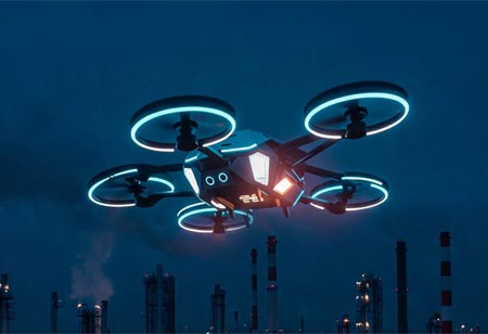
Fremont, CA: Unmanned Aircraft Systems (UAS), or drones, have undergone tremendous technological advancements over the last few years, revolutionizing industries and creating new opportunities. The technology has improved dramatically the use of drones in different industries, ranging from agriculture to surveillance. With increasing demands for more efficient, safer, and more versatile drones, the technological advancements are redefining the future of UAS in innovative and far-reaching ways. One of the most pivotal advancements is the enhancement of communication systems within drones. High-frequency communication technology has enabled more reliable connections between drones, ground stations, and even other drones. This development ensures real-time data transfer, reduces latency, and enhances control over drone operations, making them more reliable for complex tasks. This technology allows for smoother coordination and more efficient data handling, which is essential for missions requiring high levels of precision and collaboration. In addition, advancements in sense-and-avoid systems have greatly improved drone safety. These systems, equipped with LiDAR and advanced computer vision sensors, allow drones to detect obstacles in their path and make real-time decisions to avoid collisions. Such capabilities are crucial for navigating in crowded or challenging environments, significantly reducing the risk of accidents and ensuring safer operations, especially in urban areas or remote locations where obstacles may not be clearly visible. Another breakthrough in drone technology is the ability to operate Beyond the Visual Line of Sight (BVLOS). This allows drones to fly further than the pilot's direct line of sight, using advanced satellite navigation and improved flight control algorithms. BVLOS operations are essential for industries like agriculture, infrastructure inspection, and logistics, where large-scale operations need to be monitored or managed without requiring constant visual contact with the drone. This advancement expands the operational scope of drones, making them more efficient for tasks that cover extensive areas or remote regions. Artificial Intelligence (AI) has also had a large influence on drone navigation. AI-based systems allow drones to navigate through landscapes on their own, making in-flight adjustments of flight routes using information like weather or terrain status. This cuts down on human intervention and permits drones to tailor their flight plan for greater efficiency and less error. AI also assists drones in processing data better, which is useful for aerial surveying or environmental monitoring. Drones have also seen substantial improvements in payload capacity, allowing them to carry more advanced sensors, cameras, and equipment. This enhancement opens new possibilities for commercial and industrial applications, from high-resolution photography and mapping to environmental monitoring and surveillance. Drones with larger payloads can now perform more complex tasks in a single flight, which increases their value in various fields.
Unlocking the Power of SCADA Integration in Digital Projects
Friday, January 09, 2026
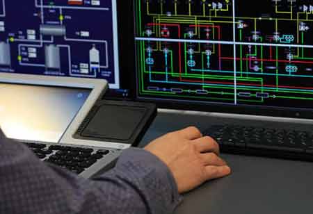
FREMONT, CA: For many years, SCADA systems have been essential for automating and controlling industrial processes, and as companies embrace digital transformation, their importance has only increased. Real-time monitoring, control, and data analytics are provided by these systems, which aid in operational optimization, safety enhancement, and better decision-making. SCADA systems' primary benefit is its capacity to provide real-time industrial process oversight and control. Operators can monitor important performance indicators, spot irregularities, and react quickly to new problems thanks to SCADA systems, which offer a thorough picture of operations. Enhanced control over processes improves operational efficiency, reduces downtime, and minimizes the risk of accidents. SCADA systems generate vast amounts of data from various points within an industrial setup. Leveraging this data is essential for digital transformation. The analysis provides valuable insights into operational trends, equipment performance, and potential areas for improvement. Companies can predict maintenance needs, leading to cost savings and increased productivity. Digital transformation aims to streamline operations and enhance efficiency. SCADA systems contribute significantly to the goal by automating routine tasks, reducing manual intervention, and improving process accuracy. Automated control loops can adjust process parameters in real-time based on data inputs, ensuring optimal performance. The integration reduces bottlenecks, enhances workflow efficiency, and improves overall productivity. SCADA systems can detect hazardous conditions and trigger alarms or automatic shutdowns to prevent accidents. The digital transformation journey often involves expanding operations and managing investments across multiple locations. The remote capability is precious for managing distributed assets and responding to issues promptly. Scalability ensures the system can handle increased data volumes and additional devices without compromising performance. Modern SCADA systems are designed to be scalable, accommodating the growing needs of an expanding organization. Predictive maintenance is a critical component of digital transformation, and SCADA systems are integral to its implementation. IoT and Industry 4.0 initiatives are driving the next wave of digital transformation, characterized by interconnected devices and smart manufacturing. SCADA systems are at the heart of these initiatives, providing the infrastructure for connecting and controlling IoT devices. It extends the lifespan of assets, reduces maintenance costs, and ensures uninterrupted operations. Integration with IoT enables real-time data exchange between SCADA systems and other smart devices, enhancing the overall intelligence and responsiveness of industrial processes. Leveraging SCADA systems for digital transformation is essential for modern industries aiming to enhance efficiency, control, and innovation. It will remain a cornerstone of effective and intelligent industrial operations. It paves the way for advanced applications such as smart grids, digital twins, and autonomous systems.
Significance of Air Purification Technology
Thursday, January 08, 2026
FREMONT, CA: Clean air is essential for human health and well-being, particularly in indoor environments where people spend much of their time. Understanding their effectiveness in real-world scenarios is crucial for informed decision-making and policy development. Various sources can compromise indoor air quality, including outdoor pollution, volatile organic compounds (VOCs) from building materials, and biological contaminants such as mold and pollen. Crowded classrooms and shared spaces can exacerbate these issues in educational institutions, potentially impacting students' health and academic performance. Several types of air purification technologies are available, including High-Efficiency Particulate Air (HEPA) filters, activated carbon filters, ultraviolet germicidal irradiation (UVGI), and photocatalytic oxidation (PCO). Each technology targets specific pollutants and employs different mechanisms to remove or neutralize them. Studies assessing the effectiveness of air purification systems in real-world settings have yielded mixed results. While laboratory experiments demonstrate the efficacy of specific technologies in controlled environments, real-world conditions present additional challenges, like varying pollutant levels, airflow patterns, and occupant behavior. The effectiveness of these systems may depend on factors such as filter maintenance, system capacity, and the presence of other indoor pollution sources. Despite their potential benefits, air purification systems have limitations that must be considered. Some technologies, such as UVGI and PCO, may generate harmful byproducts or produce ozone at levels exceeding safety standards. Cost and energy consumption are important factors to weigh when implementing these systems on a large scale. Integrating air purification technology with existing heating, ventilation, and air conditioning (HVAC) systems can enhance indoor air quality throughout a building. Centralized filtration systems can capture pollutants at the source and distribute clean air evenly, benefiting occupants in all areas. Retrofitting HVAC systems can be expensive and require careful planning and installation. Effective air purification also depends on occupants' behavior and habits. Proper ventilation, regular cleaning, and minimizing indoor pollution sources are essential for maintaining healthy indoor air quality. Educating building occupants about the importance of these practices can complement the use of air purification technology and promote a healthier living and learning environment. Air purification technology can improve indoor air quality and the health and well-being of occupants in residential and educational settings. Its effectiveness in real-world environments depends on various factors, including technology, system maintenance, integration with existing HVAC systems, and occupant behavior. Further research and monitoring are needed to optimize the use of air purification systems and ensure their long-term benefits in diverse indoor environments.


